
By Kirk Stevenson
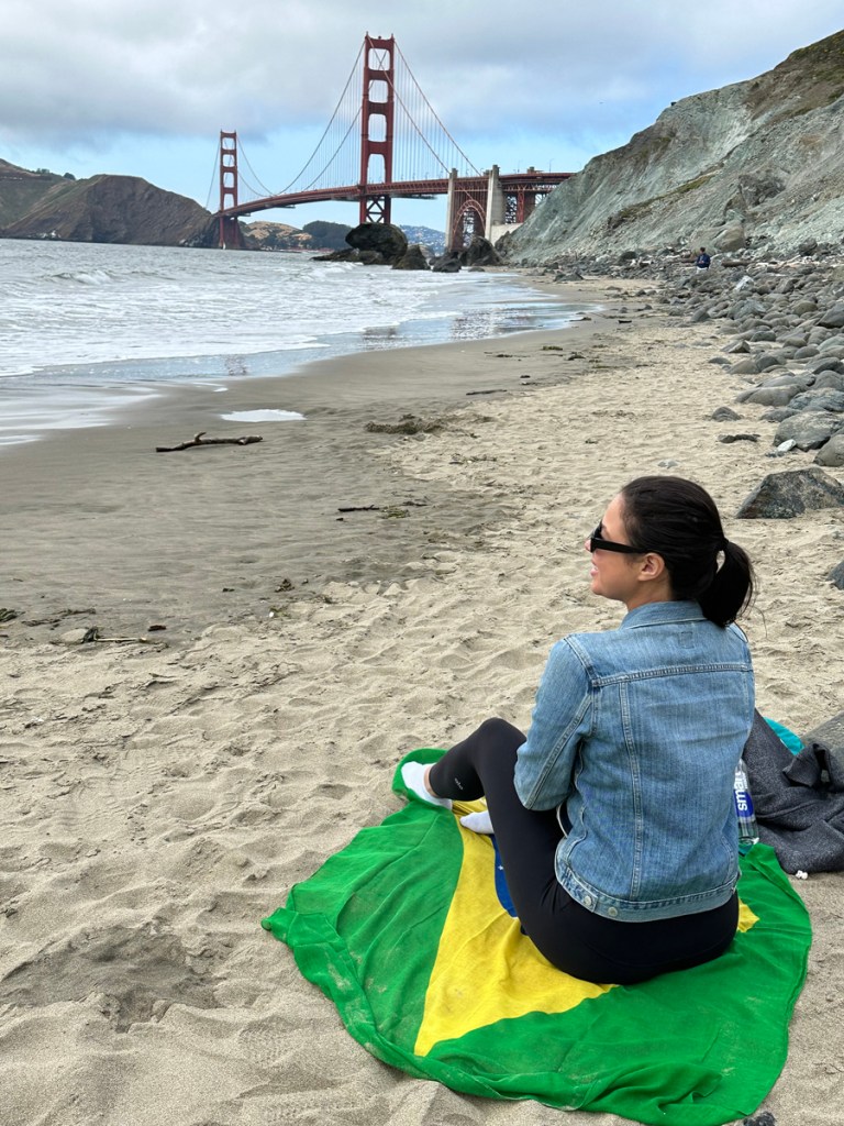
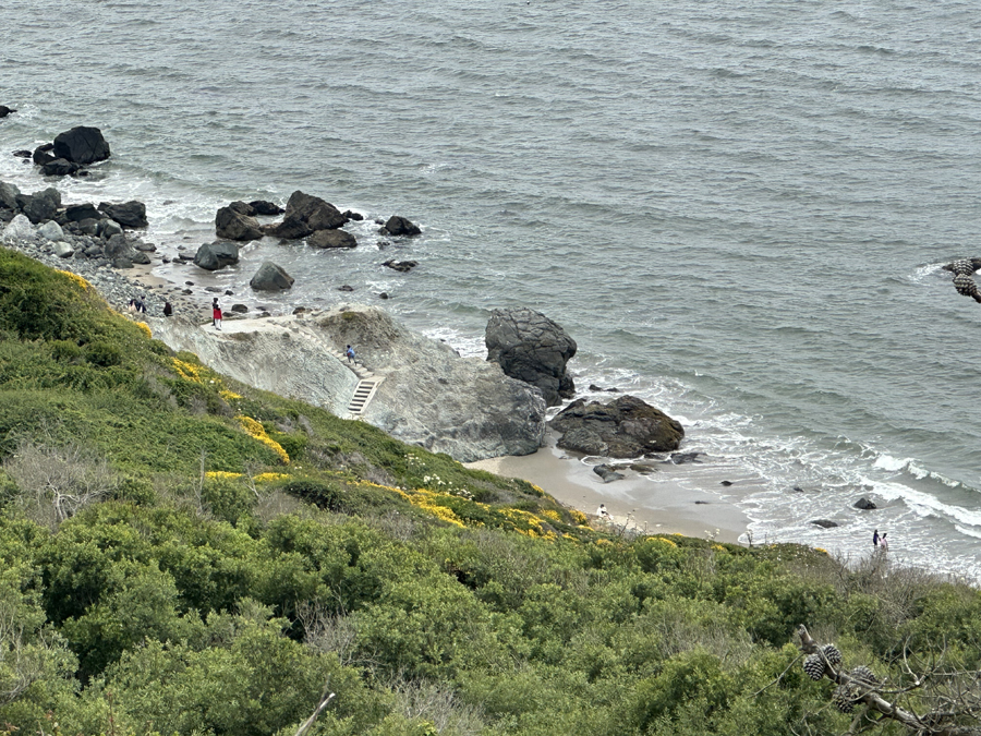
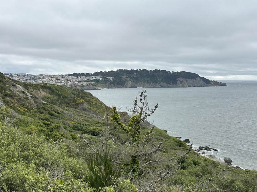
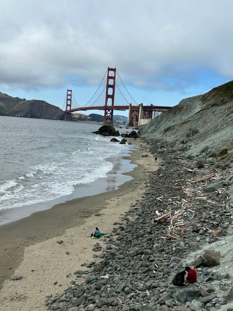
Just north of Baker Beach, tucked away along the coast of the Presidio, lies Marshall’s Beach. It is teeming with rocks and provides an iconic view of the Golden Gate Bridge with the Marin Headlands in the background.
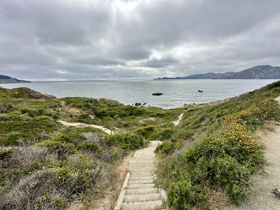
Beachgoers have accessed this isolated shoreline by walking along the Battery to Bluffs trail, the connecting path between Marshall’s Beach and Baker Beach. Its size and coarse landscape leave this beach overshadowed by its counterpart to the south.
Regarded as one of San Francisco’s best hidden beaches, the origins and history surrounding Marshall’s Beach is not wholly clear. Compared to its surroundings, the Battery to Bluffs trail is rather young, having been introduced in 2007 as an access point for Marshall’s Beach.
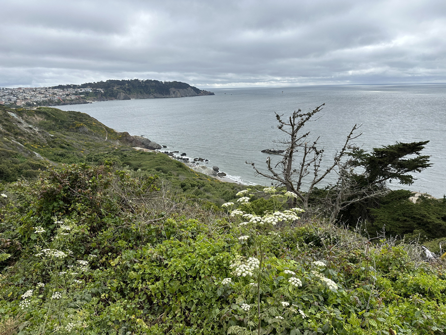
Perched in the ocean directly in front of the beach is Helmet Rock, an islet recognized specifically by its white colored top. The rock shares the name with another nearby formation at Lands End – notably photographed by Ansel Adams. The Helmet Rock across from Marshall’s Beach has been referred to as far back as the early 1900s.
A query posted on the editorial page of a 1912 edition of the San Francisco Call revealed that pieces of Helmet Rock had fallen off in 1898 and again in April of 1906, likely due in part to the earthquake that occurred that year.
Dating back to the mid-19th century, Marshall’s Beach was one of the locations where a wooden water flume would run through to provide water to Fort Mason.

John Martini grew up in San Francisco and worked for the National Park Service for 25 years.
“The water just by gravity flew through a wooden flume all the way around the tip of Fort Point all through the Presidio, across the future Marina District several miles long,” Martini said.
The flume was constructed by the Spring Valley Water Company and started in Lobos Creek which runs along the southern border of the Presidio.
Martini had other historical insights about Marshall’s Beach, including details about its landscape. He said the Presidio, known for its multiple military fortifications and installations, placed a searchlight down by the beach at the turn of the century.
Most bunkers along the coast would have been constructed in the very late 1800s. Constructed in 1864, Battery West is the nearest military battery installation to the beach.
Sources add that along with the various military installations along the bluffs, the Frank Jones, a cargo ship headed out of port in San Francisco, wrecked by Marshall’s Beach in late March 1877 due to a break in the tow lines from a tugboat. Pictures from the time of the wreck show the rugged shoreline in the foreground.
Marshall’s Beach offers a vantage point for unique views of the Golden Gate Bridge and the Pacific Ocean.

The National Park Service website offers a description of the rock face above the beach.
“The blue-green serpentinite rock seen here is part of a mélange, a mish-mash of serpentinite, sandstone and soft mudstone deposits. The mélange likely formed when a variety of marine rocks slipped down into a deep-sea trench during giant earthquakes many tens of millions of years ago,” according to the NPS website.
“The beach requires some effort to get to, however,” the Fog City Secrets website says. “The path down to the beach from the bluffs above is long; coming back up is a real workout! But it’s worth it.”
Due to its remote access, Marshall’s Beach gained a reputation as an unofficial clothing-optional area. A nickname for the coastline is “bad boy beach,” presumably because of the men who would gather there to take advantage of the lack of onlookers.
Marshall’s Beach today is a popular hike-in destination for photographers and Golden Gate Bridge view seekers. Prior to all of this, notable photographer Eadweard Muybridge used Marshall’s Beach as the stage for photos he took of Fort Point around 1869-1870. Muybridge is best known for his illustrative motion photography and had a significant array of photos during his time in San Francisco in the mid to late 1800s.
There is very little information surrounding the origins of the name of the beach. Marshall’s Beach does not credit its namesake to a prominent politician or dairy farmer like its neighbor Baker Beach. Martini commented that there is suspicion around the name being given by locals and over the decades it ended up sticking. He describes that as far as what’s known, the reason for the beach’s name is lost in time, an apt case for SF’s hidden beach.


Categories: Presidio


Thank you. Wonderful article about the natural beauty of our coastline. May we always be grateful.
LikeLike