
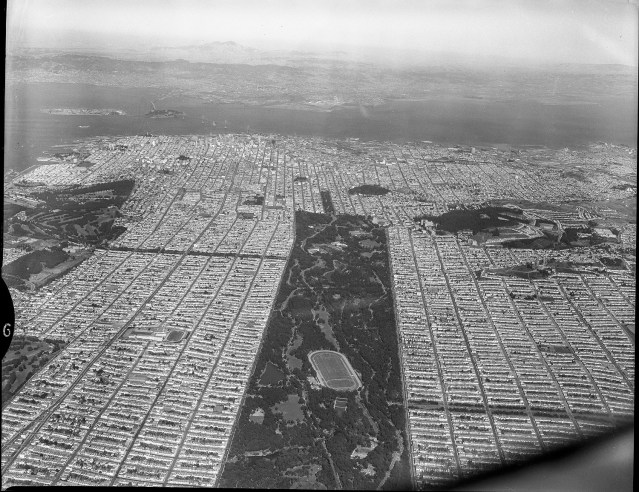
This aerial photograph, circa 1950, shows the Richmond District to the left, Golden Gate Park in the middle, and the Sunset District to the right. The Presidio Golf Course is visible to the left. In the middle of the park the Polo Field is visible. In the upper right homes are under construction on the south side of Mount Sutra. Photo courtesy of private collector/Western Neighborhoods Project


Great shot, Please post more!
LikeLike